


I set out to explore layered history where medieval streets and collapsed arches tell stories of survival. In this guide I focus on why so many towns were deserted and how to visit safely.
I describe my firsthand visit to Craco in Basilicata, a place slowly emptied by landslides and now a UNESCO candidate. I explain how many sites sit beside modern settlements labeled Nuovo or Vecchio, so you won’t confuse maps and road signs.
Practical advice follows: where access is safe, what permissions you may need, and when the landscape looks best for photos. I also stress that these sites are fragile and deserve respectful travel today.
Key Takeaways
- I preview why the south is rich in abandoned places and how Craco illustrates that history.
- Many villages remain accessible, but some require guided access for safety.
- Look for nearby settlements named Nuovo or Vecchio to avoid confusion.
- Plan for road conditions, seasons, and local rules before you go.
- Explore carefully — these quiet places are both photogenic and fragile.
Why I’m drawn to Italy’s abandoned villages and what to expect on the trail
Walking through abandoned alleyways taught me to read small traces of everyday life. That slow focus bends my sense of time and makes details—an inscription, a doorstep—feel alive again.
I learned these places were emptied for many reasons: earthquakes, landslides, floods, and waves of migration as people sought safer work. Those natural disasters often combine with economic decline to shape the paths you can still walk.
Expect uneven ground, roped-off sections, and fresh rockfall or leaning walls that warn you to keep back. Some sites are partly curated and monitored, while others remain raw and unstable.
My advice is simple: treat the area as fragile. Stay on marked paths, avoid entering closed structures, and let nature reclaim space without speeding the process. The quiet experience—tracing steps carved long ago—connects you to the life that was once part of each village.
Craco, Basilicata: my haunting hilltop encounter
I reached Craco at dusk, the ridge cutting a stark silhouette against the fading light. The place felt paused between living memory and open air ruins.
From medieval stronghold to landslides and the final evacuations in the 1960s
Craco was founded centuries ago and survived plague, bandit raids, and political turmoil. Repeated slope failures and an accelerating pattern of landslides pushed many residents downhill by the 1960s.
The layout still reads like a fortified town: a castle rise, the parish church, and narrow plazas that mark long layers of local history.
On the silver screen
Filmmakers used Craco’s dramatic silhouette for major productions, including The Passion of the Christ and Quantum of Solace. Standing where a scene was shot added a strange echo to the real story beneath the stone.
How I visited safely
- I joined an official tour; guides control access for safety and context.
- Expect closed interiors, roped alleys, and clearly marked overlooks.
- Best light and fewer crowds came late afternoon for photos of the village line against canyon walls.
“Silence moves through the broken windows and makes the past feel immediate.”
| Access | Main sights | Notes |
|---|---|---|
| Guided tours | Castle rise | Steep drops; stay on paths |
| Official entry points | Church façade | Interiors off-limits |
| Late afternoon recommended | Piazza ruins | Unstable buildings |
ghost towns southern Italy: my must-visit list beyond Craco
My route took me beyond Craco to villages where stone streets keep visible scars and unexpected life.
Pentedattilo, Calabria
The name and the five-finger shape of the rock announce drama. Damaged in the 1783 earthquake, Pentedattilo was nearly empty by the 1960s.
Artists now run small studios and festivals that bring back a spark of life.
Roghudi Vecchio, Calabria
This former Greek-speaking community was abandoned in 1971 after floods and landslides. The mountain approach shows why people left.
Expect narrow, poorly kept roads or a long hike to reach the site safely.
Cirella Vecchia, Calabria
Perched above the Tyrrhenian, Cirella suffered plagues, quakes, and an 1806 bombardment. A small car park makes a quick stop possible.
Africo Vecchia, Calabria
Founded in the 9th century, Africo endured famines and repeated quakes. After 1952 floods residents moved to Africo Nuovo on the coast.
Access is rough; consider hiking from Bova if roads are uncertain.
Roscigno Vecchia & Apice Vecchio
Roscigno feels frozen in time, with a lone caretaker and an organized foundation. Apice offers intact streets, plaques, and a restored castle used for events.
Bussana Vecchia (bonus)
In Liguria the 1887 quake cleared a path for artists in the 1960s. Galleries and workshops show one way ruins can find new purpose.
| Site | Main cause | Access | Why visit |
|---|---|---|---|
| Pentedattilo | 1783 earthquake | Easy detour from Melito | Studios, festivals, dramatic rock shape |
| Roghudi Vecchio | Floods & landslides | Winding mountain roads or hike | Stark, remote approach explains abandonment |
| Cirella Vecchia | Plagues, quakes, bombardment | Small car park at ruins | Coastal views; short visit |
| Africo Vecchia | Quakes, famine, floods | Challenging roads; hike recommended | Haunting isolation and history |
| Roscigno / Apice | 1960s earthquakes | Managed sites; nearby services | Intact streets, restored castle, events |
“Pair nearby sites to balance access with the best vistas and stories.”
Why so many towns were abandoned: the forces that shaped the landscape
I’ve seen how the land itself can turn a thriving settlement into a quiet ruin over a few harsh seasons. Across regions, a mix of geology, weather, and human choices made some places unsafe to live in the long run.
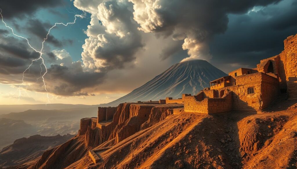
Natural hazards that reshaped places
Seismic shocks and shifting slopes loosen rock and soil. Heavy rains then trigger landslides or floods that can make a town dangerous after repeated events.
Fragile tufa and erodible cliff faces worsen the problem. Over years, one unstable slope can force an entire community to relocate for safety.
Economic decline and migration
In the late 19th and 20th century many inhabitants left for factories, ports, or to emigrate abroad. Fields, shops, and workshops emptied as job opportunities drew residents away.
When younger generations depart, remaining services shrink and the cost of rebuilding after disasters becomes harder to cover.
War, damage, and long-term loss
Bombardment and occupation during wars destroyed infrastructure that small towns could not afford to replace. Places like Gessopalena retain ruins that double as open-air memory sites.
“When safety, work, and identity pull in different directions, whole settlements can disappear from the map.”
- Geology + weather undermine foundations, turning safe sites into risk zones.
- Authorities sometimes relocate residents en masse to preserve lives.
- Many sites survive in part, with cores stabilized while peripheral blocks decay.
Planning your route in the south: regions, seasons, and pacing your time
I plan routes that pair dramatic ruins with practical travel windows to get the most out of every visit.
I map trips by region: Basilicata for Craco, Calabria for rugged hill sites like Pentedattilo and Roghudi Vecchio, and Campania for more intact layouts. Clustering sites in the same area cuts backtracking and saves time.
Spring and autumn are my preferred seasons. Cool air makes walking easier and views clearer. Summer heat shortens safe hiking windows, while winter weather can close passes or make slopes slippery.
I plan conservative drive times from a nearby city base, especially where roads get narrow or broken. I build in buffer days for weather and unexpected closures so the route can flex without ruining the trip.
- I mix guided tours with independent stops: book official access where needed and use viewpoints for quick visits.
- I prefer a small group on logistics-heavy days to share a driver or guide and simplify access.
- I carry paper maps or offline apps and pin trailhead and car-park coordinates in advance.
- I cap daily visits at two or three towns so there’s time to absorb context instead of rushing a checklist.
“Cluster by region, plan for weather, and leave room to stay longer where the site rewards the visit.”
Safety, access, and tours: how I keep explorations low-risk
Before I step inside any ruined village, I make a quick visual sweep for recent shifts in stone and earth.
Signs to watch on approach
I look for fresh cracks, fallen masonry, bowed walls, and fencing that marks danger zones. These clues show where collapse or rockfall is active after past disasters.
I never enter buildings even when doors stand open. Hidden voids and weakened lintels can fail without warning.
Guided options vs. solo visits
I prefer tours when access is controlled or roads are tricky. Guides know recent slide reports and safe routes in the area.
When I go solo, I share coordinates and a return time with someone off-site. I carry basic gear: a helmet for exposed sectors, gloves, headlamp, and plenty of water for long, dry stretches of air and sun.
- Quick risk scan: check façades, slopes, and loose masonry.
- Follow signage: roped alleys mean real structural risk.
- Low impact: no climbing, no moving debris—respect residents and caretakers.
“Prioritize safe access and local guidance; it keeps both people and fragile fabric intact.”
Travel with respect: preserving ruins and honoring former residents
My aim is to leave every site in better condition than I found it. I travel slowly and listen to local advice before crossing a boundary or stepping onto fragile ground.
Boundaries and ownership: closed gates, restoration zones, and private property
Many abandoned places remain unstable and partly privatized. Some are curated by municipal projects or small foundations.
I’ve seen Roscigno Vecchia kept as a preserved layout by an unofficial caretaker. I’ve also watched Bussana Vecchia become an artists’ community with galleries and restored workshops where art helps fund upkeep.
- I stay outside closed gates and fenced restoration zones; legal ownership matters even when a town seems empty.
- I do not remove stone or artifacts; each piece supports conservation and archaeological work.
- I treat a church or memorial with quiet respect, whether roofed or roofless, and avoid disturbing services or plaques.
- I avoid tagging, rearranging buildings, or staging intrusive photos that speed decay.
- I ask before flying drones and support local efforts by paying fees, hiring guides, or donating to small foundations.
- I leave nature—wildflowers, lizards, nesting birds—undisturbed; they are part of the site’s recovery.
“Respect preserves the memory and lets communities keep a living part of their history.”
Conclusion
I close this guide with a simple ask: visit slowly, notice details, and treat each place as a fragile archive of life.
I walked Craco, Pentedattilo, Apice Vecchio, Africo Vecchia, and Cirella Vecchia and saw how earthquakes, landslides, floods, war, and economic shifts made thousands of abandoned villages across the country.
Pick one Italy itinerary—Craco plus a Calabrian village—and give it time. Choose guided access where needed and pause at open overlooks to let the experience settle.
Remember that a church façade, a scatter of stone, or a single plaque can hold a century of people and memory. Travel responsibly and help these ghost town places endure for years to come.